
Home › Guides
Guide
A short history of Periyar: the lake, the forest and the reserve
From a dam finished in 1895 to a game sanctuary, a tiger reserve and an eco-development model: how Periyar's lake and forest came to be what they are.
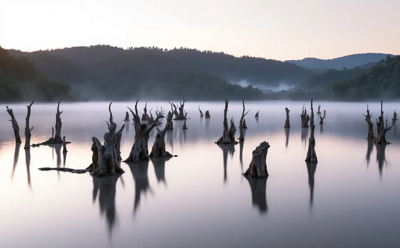
Most visitors meet Periyar through its lake: a long, branching sheet of water with the grey trunks of drowned trees standing in it, elephants on the grassy shore and forest climbing every slope. It looks ancient. It is not. The lake is a little over a century old, the protected forest around it grew in stages through the twentieth century, and the way the reserve is run today owes a good deal to an experiment with the villages at its edge that began in the 1990s.
This page is the journal's outside account of that history, put together from published sources: government and National Tiger Conservation Authority material, World Bank project documents, and the reference works that summarise them. Where sources give slightly different dates, we say "around". We are writers and travellers, not historians of the Forest Department, so treat this as an orientation and follow the named sources if you want the detail.
Before the dam
The Periyar river rises in the high forests of the Cardamom Hills, in what is now the southern part of Idukki district, and flows north and west towards the Arabian Sea. For centuries these hills were part of the kingdom of Travancore. The forests were used, but lightly by modern standards: forest-dwelling communities collected honey, bark, resins and other produce, and the spice trade drew pepper and cardamom down to the coast from slopes all around this country.
The forest was also on the edge of a much drier world. Just over the eastern ridge lie the plains of what was then the Madras Presidency, where the rain shadow of the Western Ghats leaves farmland short of water. Engineers and administrators in Madras had looked for decades at the idea of turning some of the Periyar's water east, through the hills, to irrigate those plains.
The Mullaperiyar dam and the lake
That idea became the Mullaperiyar dam. The arrangement rested on a long lease signed in 1886 between the Maharaja of Travancore and the British Secretary of State for India, which gave the Madras side rights to build the works and use the water. Construction began in 1887 under the British army engineer John Pennycuick, and the dam was completed in 1895. It is a masonry gravity dam, built near the meeting of the Mullayar and the Periyar, which is where the name comes from.
Behind it, water filled the forested valleys. The lake that formed follows the old river courses, which is why it has so many arms, bays and narrow fingers reaching into the forest, and why its shoreline is so much longer than its size suggests. The trees in the flooded valleys died where they stood, and their trunks are the stumps that still rise from the shallows today, used as perches by cormorants and darters. Through a tunnel cut through the ridge, the water goes east to irrigate farmland in what is now Tamil Nadu.
Within a few years, the forest around the new lake was given protection of its own. Reference sources record a Periyar Lake Reserve formed around 1899, an early step that set the lake and its surroundings apart from ordinary forest use.
From game sanctuary to wildlife sanctuary
In 1934 the Travancore government declared the forests around the lake a game sanctuary, usually named in the sources as the Nellikampatty (also spelt Nellikkampatty) Game Sanctuary. Accounts link the decision partly to concern about plantations pushing into the forest. Accounts of that period also mention a game warden appointed for the area around 1933, which suggests that protection was beginning to be organised on the ground and not only on paper.
After independence, Travancore merged with Cochin and later became part of the new state of Kerala. In 1950 the protected area was consolidated as the Periyar Wildlife Sanctuary. The sanctuary years were when Thekkady, on the lake shore near Kumily, became known as a place where ordinary travellers could watch wild elephants, gaur and sambar from the water, a reputation it still has.
Project Tiger and the national park
India launched Project Tiger in 1973 to protect tigers and their habitat through a network of reserves with dedicated management. Periyar was brought into it in 1978, when the sanctuary was declared a tiger reserve. The National Tiger Conservation Authority's list of reserves gives the original creation as 1978 to 1979.
In 1982 the most important part of the reserve, a core of roughly 350 square kilometres, was notified as Periyar National Park, the highest category of protection under Indian wildlife law. Elephants received their own national scheme, Project Elephant, in the early 1990s, and the forests here later formed the heart of the Periyar Elephant Reserve under it.
The reserve's size has changed over the decades. Older documents, including the World Bank project papers of the 1990s and 2000s, describe it as around 777 square kilometres. Later additions, including forest in the Goodrical range, brought it to the figure the National Tiger Conservation Authority now gives: about 925 square kilometres, of which 881 are core or critical tiger habitat and 44 are buffer. For how the tigers themselves are counted, see the piece on what monitoring shows about Periyar's tigers.
Two divisions and a pilgrim shrine
A reserve this size is not managed from one office. In the early 2000s it was split for administration into Periyar East and Periyar West divisions. The eastern side holds Thekkady, the lake and most of the visitor activity most people know. The western side runs down towards the Pamba river valley.
That western part also holds Sabarimala, one of the largest Hindu pilgrimage sites in south India, dedicated to Lord Ayyappa. During the main pilgrim season, roughly from mid-November to mid-January, very large numbers of pilgrims walk forest paths and travel roads inside and around the reserve. A 2007 World Bank evaluation described the pilgrimage as one of the main pressures the reserve has to manage, alongside poaching in remote areas and the needs of villages and estates on the fringe. It is also a reminder that the reserve has never been an empty wilderness: it is a sacred place for many people and the working country of farms and estates for others.
The eco-development era
By the early 1990s Periyar had a problem common to many Indian reserves. Thousands of families lived in villages, settlements and estates close to the boundary, and many depended on the forest for firewood, grazing, bark, fish and other produce. Some collected sandalwood or poached animals. Relations between forest staff and neighbouring people were often tense.
The response was eco-development. In 1996 the World Bank approved the India Eco-development Project, financed by the International Development Association together with a grant from the Global Environment Facility, with funds from the Government of India and the states. It ran in seven protected areas, Periyar among them, and closed in 2004. Its central idea was to reduce pressure on the forest by investing in the villages around it, in exchange for reciprocal commitments from those villages to protect it.
At Periyar this was done through eco-development committees, known as EDCs, which planned local works, ran savings and credit groups and took on duties such as patrolling. The World Bank's completion report records 72 EDCs at Periyar covering about 5,540 households, and notes that some committees were organised by profession or by user group, so that people who had depended on the same forest resource worked together. A later evaluation by the Bank's independent evaluation group chose Periyar as the most successful of the seven sites, and recorded that converting poachers and other trespassers into eco-tourism guides had reduced poaching.
Those programmes, from trekking and nature walks to rafting on the lake, are the origin of the community-based tourism that Periyar is known for. The guide to community eco-tourism looks at how they worked, what assessments found and what their limits were.
A foundation for the reserve
To keep eco-development going after the project ended, a trust usually called the Periyar Foundation was set up in 2004 to receive a share of visitor revenue and put it back into conservation and community work, and the 2006 amendments to India's wildlife law later provided for a foundation of this kind at every tiger reserve.
The dam debate
The Mullaperiyar dam is also the subject of one of south India's best-known interstate disputes. Kerala, where the dam stands, has raised concerns about the safety of a structure well over a century old in a region of heavy rain, and has argued for a new dam or a lower water level; Tamil Nadu, which operates the dam and relies on its water for irrigation and drinking supplies in several districts, has maintained that the strengthened dam is safe and has sought a higher level. The Supreme Court of India has ruled on the matter more than once, including judgments in 2006 and 2014 on the permitted water level, and the question of the dam's future continues to come back to the courts and expert committees.
For a visitor, the practical point is simple: the lake you see is a reservoir, and its level rises and falls with the monsoons and with decisions about the dam. A high lake drowns the grassy margins; a low one exposes wide banks where elephants and gaur come to graze.
Timeline
| Year | Event |
|---|---|
| 1886 | Lease signed between Travancore and the British Secretary of State for India for the Periyar irrigation works |
| 1887 | Construction of the Mullaperiyar dam begins |
| 1895 | Dam completed; the lake forms in the Periyar valley |
| Around 1899 | Periyar Lake Reserve formed |
| 1934 | Nellikampatty Game Sanctuary declared by the Travancore government |
| 1950 | Periyar Wildlife Sanctuary constituted |
| 1973 | Project Tiger launched nationally |
| 1978 | Periyar declared a tiger reserve under Project Tiger |
| 1982 | Core area of about 350 square kilometres notified as Periyar National Park |
| 1996 | India Eco-development Project approved; eco-development committees formed around Periyar from the late 1990s |
| Early 2000s | Reserve divided into Periyar East and Periyar West divisions |
| 2004 | Eco-development project closes; Periyar Foundation set up |
| 2006 and 2014 | Supreme Court judgments on the dam's water level |
| Later 2000s | Additions bring the reserve to about 925 square kilometres |
Reading further
The story above is only a frame. The reserve has a long research record, from botanical surveys to fish and elephant studies, which is summarised in what decades of research tell us about Periyar. The World Bank's own documents on the eco-development project, including its completion report and the later performance assessment, are public and worth reading for anyone curious about how a reserve and its neighbours can come to an arrangement; search the Bank's documents library for "India Ecodevelopment Project".
If you visit, one small thing helps the history make sense. Take a morning on the lake and look closely at the stumps. Each one is a tree that grew in a river valley before 1895, and the shoreline you are following was a hillside until the water rose.